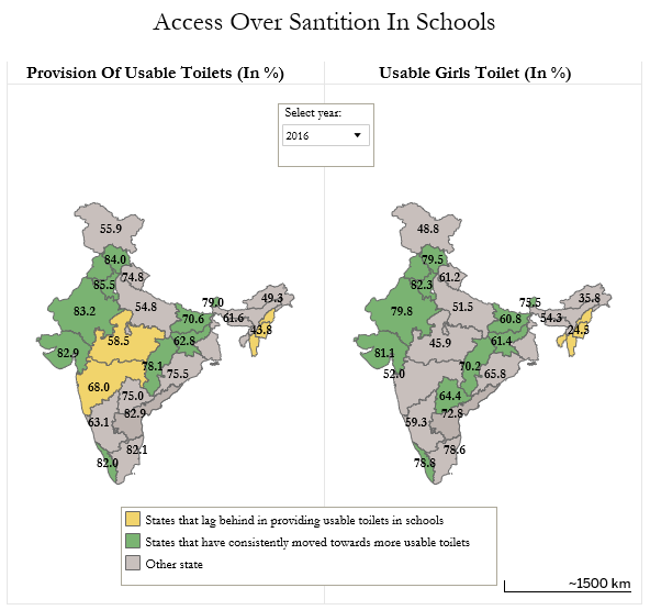
This week a makeover of an article and Tableau chart about sanitation in rural Indian schools, based on data from the ASER Centre. Here is the original chart posted by Eva and Andy:
Made over
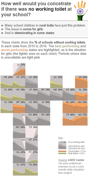
A tile map seemed like a good way to retain some of the benefits of the map whilst mitigating the downsides. It was an interesting exercise to make a tile map for India and the end result still retains some similarity to an outline of India. The addition of imagery featuring the Indian flag reinforces the fact that the viz is about India, and I like the analogy of a child putting their hand up to ask to go to the toilet!.
I’ve attempted to reframe the figures so that I could highlight the additional proportion of schools with no working girls toilet. And the final design decision was a headline and sub-title to bring the implications and key points into focus for the reader.
